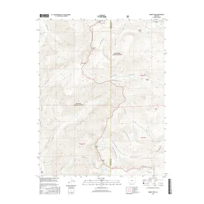
2016 Map of Summit Peak
USGS Topo · Published 2016About this map
Summit Peak stands as the literal and topographic centerpiece of this high-altitude landscape where the Continental Divide defines the watershed and the boundary between Rio Grande National Forest and San Juan National Forest. This 2016 survey documents a wilderness defined by its network of trails rather than roads, with the Continental Divide National Scenic Trail winding past Montezuma Peak and Gunsight Pass. To the east, the headwaters of the Adams Fork and Middle Fork Conejos River emerge from high basins, while the Rio Blanco carves westward toward Blanco Basin. The geography is dotted with remote alpine landmarks like Lake Ann, Fish Lake, and Haskell Rincon, reflecting a terrain that has remained largely untouched by modern development. This sheet captures the region's character as a critical divide in the American West, where the drainage systems of the Atlantic and Pacific begin their long journeys.
Find a feature on this map
37 named features on this map. Tap any name to fly to it.
Don’t see what you’re looking for? This feature index may not catch every label — zoom into the map to look around manually.
Map Details
Editions of this 2016 Summit Peak Map
This is the sole edition of this map. No revisions or reprints were ever made.
Other maps of this area

1913 · Summitville
USGS Topo · 1:125,000

1915 · Summitville
USGS Topo · 1:125,000

1945 · Durango
USGS Topo · 1:250,000

1953 · Durango
USGS Topo · 1:250,000

1954 · Durango
USGS Topo · 1:250,000

1957 · Chromo
USGS Topo · 1:62,500

1957 · Wolf Creek Pass
USGS Topo · 1:62,500

1957 · Chama Peak
USGS Topo · 1:62,500

1961 · Durango
USGS Topo · 1:250,000

1963 · Durango
USGS Topo · 1:250,000