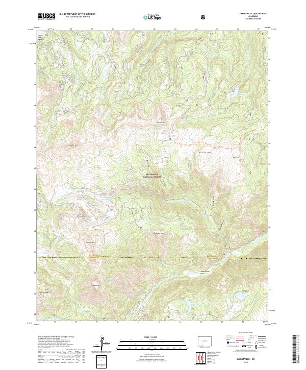
2022 Map of Summitville
USGS Topo · Published 2022About this map
Rio Grande National Forest dominates this high-altitude landscape where the boundary between Rio Grande and Conejos counties follows the ridgeline of the San Juan Mountains. The presence of the Summitville Tailings Pond at the headwaters of the Wightman Fork is a stark marker of the area's complex mining history and subsequent environmental reclamation efforts. This modern survey shows the industrial legacy alongside natural landmarks like Elephant Mtn and Cropsy Mtn. High-country water management is evident through features such as Fuchs Reservoir and Kerr Lake, while the Alamosa River drains the southern slopes below Government Park. The network of creeks, including Race Cr and W Fork Pinos Cr, illustrates the intricate drainage patterns of the Continental Divide.
Find a feature on this map
43 named features on this map. Tap any name to fly to it.
Don’t see what you’re looking for? This feature index may not catch every label — zoom into the map to look around manually.
Map Details
Editions of this 2022 Summitville Map
This is the sole edition of this map. No revisions or reprints were ever made.
Other maps of this area

1913 · Summitville
USGS Topo · 1:125,000

1914 · Creede
USGS Topo · 1:125,000

1915 · Summitville
USGS Topo · 1:125,000

1915 · Del Norte
USGS Topo · 1:125,000

1916 · Creede
USGS Topo · 1:125,000

1917 · Del Norte
USGS Topo · 1:125,000

1922 · Conejos
USGS Topo · 1:125,000

1945 · Durango
USGS Topo · 1:250,000

1953 · Durango
USGS Topo · 1:250,000

1954 · Durango
USGS Topo · 1:250,000