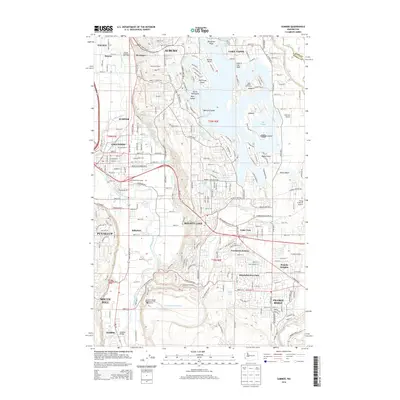
2014 Map of Sumner
USGS Topo · Published 2014About this map
Lake Tapps dominates the eastern landscape of this region, its intricate shoreline defined by numerous islands and points like Bankers Island and Evergreen Point. The water-based infrastructure of the early 21st century is evident through the Penstock Tunnel near Dieringer and the presence of the Tapps Island Golf Course. To the west, the White River and Puyallup River valleys provide the primary corridors for transportation and settlement, connecting Sumner and Bonney Lake via the Wahl Road Interchange. Local industry and conservation are reflected in the Sumner Pit and the Trout Spring Hatchery, while aviation is served by small facilities such as Albritton Airport. This topographic study illustrates the transition between the developed residential communities of Prairie Heights and the riparian lowlands near the McMillin.
Find a feature on this map
77 named features on this map. Tap any name to fly to it.
Don’t see what you’re looking for? This feature index may not catch every label — zoom into the map to look around manually.
Map Details
Editions of this 2014 Sumner Map
This is the sole edition of this map. No revisions or reprints were ever made.
Other maps of this area

1897 · Tacoma
USGS Topo · 1:125,000

1900 · Tacoma
USGS Topo · 1:125,000

1941 · Tacoma South
USGS Topo · 1:62,500

1942 · Lake Tapps
USGS Topo · 1:62,500

1944 · Lake Tapps
USGS Topo · 1:62,500

1944 · Tacoma South
USGS Topo · 1:62,500

1949 · Black Diamond
USGS Topo · 1:24,000

1949 · Poverty Bay
USGS Topo · 1:24,000

1949 · Auburn
USGS Topo · 1:24,000

1956 · Orting
USGS Topo · 1:24,000