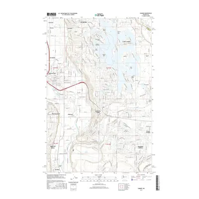
2017 Map of Sumner
USGS Topo · Published 2017About this map
Lake Tapps dominates the eastern portion of this landscape, its intricate shoreline defined by numerous points and islands such as Driftwood Point, Bankers Island, and Scout Island. This engineered water body is linked to the industrial character of the valley below, evidenced by the Penstock Tunnel near Dieringer. The river systems are central to the area's geography, with the White River and Puyallup River carving through the lowland plains. These waterways historically supported the growth of settlements like Sumner, Pacific, and McMillin. On the higher ground to the south, residential expansion is visible in Prairie Ridge and Prairie Heights. The map also preserves the footprint of regional infrastructure and industry, from the BNSF Railway corridor to the Trout Spring Hatchery and local aviation sites like Albritton Airport.
Find a feature on this map
243 named features on this map. Tap any name to fly to it.
Don’t see what you’re looking for? This feature index may not catch every label — zoom into the map to look around manually.
Map Details
Editions of this 2017 Sumner Map
This is the sole edition of this map. No revisions or reprints were ever made.
Other maps of this area

1897 · Tacoma
USGS Topo · 1:125,000

1900 · Tacoma
USGS Topo · 1:125,000

1941 · Tacoma South
USGS Topo · 1:62,500

1942 · Lake Tapps
USGS Topo · 1:62,500

1944 · Lake Tapps
USGS Topo · 1:62,500

1944 · Tacoma South
USGS Topo · 1:62,500

1949 · Black Diamond
USGS Topo · 1:24,000

1949 · Poverty Bay
USGS Topo · 1:24,000

1949 · Auburn
USGS Topo · 1:24,000

1956 · Orting
USGS Topo · 1:24,000