2023 Map of Sumner
USGS Topo · Published 2023About this map
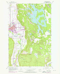
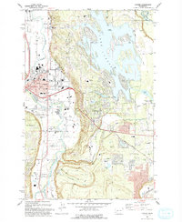
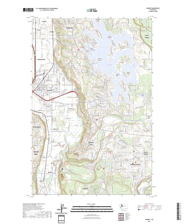
Lake Tapps dominates the northeastern landscape of this region, its intricate shoreline defined by numerous points and islands like Evergreen Point and Bankers Island. The geography transitions from these uplands down into the productive Puyallup Valley, where the White River and Puyallup River converge near the heart of Sumner. This area shows a dense network of suburban expansion alongside industrial and agricultural legacies, visible in the proximity of the Sumner Pit to established residential communities like Alderton and McMillin. Local infrastructure is marked by specialized sites such as the Trout Spring Hatchery and several small aviation strips, including Albritton Airport. The map also traces the significant elevation changes along Elhi Hill Rd, where the terrain rises sharply from the river plains toward the growing developments of Bonney Lake and Tehaleh.
Find a feature on this map
68 named features on this map. Tap any name to fly to it.
Don’t see what you’re looking for? This feature index may not catch every label — zoom into the map to look around manually.
Map Details
Editions of this 2023 Sumner Map
This is the sole edition of this map. No revisions or reprints were ever made.