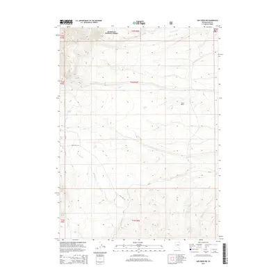
2015 Map of Sun Creek NW
USGS Topo · Published 2015About this map
Humboldt National Forest and the northern reaches of the Marys River Range anchor this high-desert landscape in Elko County. The map shows a drainage system of seasonal and perennial waters, including Sun Creek, Wild Horse Creek, and Wildcat Creek, which descend from higher elevations toward the expansive O'Neil Basin. This network of riparian corridors was historically essential for livestock and travel in the Great Basin.
Find a feature on this map
22 named features on this map. Tap any name to fly to it.
Don’t see what you’re looking for? This feature index may not catch every label — zoom into the map to look around manually.
Map Details
Editions of this 2015 Sun Creek NW Map
This is the sole edition of this map. No revisions or reprints were ever made.
Other maps of this area

1943 · Jarbidge
USGS Topo · 1:62,500

1945 · Jarbidge
USGS Topo · 1:62,500

1955 · Wells
USGS Topo · 1:250,000

1957 · Elk Mountain
USGS Topo · 1:62,500

1958 · Wells
USGS Topo · 1:250,000

1961 · Wells
USGS Topo · 1:250,000

1968 · Marys River Basin NE
USGS Topo · 1:24,000

1968 · Marys River Basin SE
USGS Topo · 1:24,000

1968 · Hot Creek
USGS Topo · 1:24,000
1968 · Stormy Peak
USGS Topo · 1:24,000