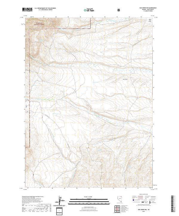
2021 Map of Sun Creek NW
USGS Topo · Published 2021About this map
The Humboldt National Forest anchors the northwestern corner of this high-desert landscape in Elko County, where the Marys River Range provides a dramatic backdrop to the broad O'Neil Basin. This 2021 survey illustrates a remote ranching and grazing environment defined by a network of seasonal water sources and utilitarian paths. Essential water points like Antelope Spring, Buffalo Spring, and Dry Creek Spring serve as vital landmarks across the arid terrain. The map details the historical transit routes connecting the region, notably the Deeth O'Neil Rd and O'Neil-Deeth Co Rd, which trace the drainage of Wild Horse Cr. These roads, along with backcountry routes like Willow Trl and Horse 3 Trl, reveal the enduring infrastructure of Nevada’s Great Basin ranching country.
Find a feature on this map
24 named features on this map. Tap any name to fly to it.
Don’t see what you’re looking for? This feature index may not catch every label — zoom into the map to look around manually.
Map Details
Editions of this 2021 Sun Creek NW Map
This is the sole edition of this map. No revisions or reprints were ever made.
Other maps of this area

1943 · Jarbidge
USGS Topo · 1:62,500

1945 · Jarbidge
USGS Topo · 1:62,500

1955 · Wells
USGS Topo · 1:250,000

1957 · Elk Mountain
USGS Topo · 1:62,500

1958 · Wells
USGS Topo · 1:250,000

1961 · Wells
USGS Topo · 1:250,000

1968 · Marys River Basin NE
USGS Topo · 1:24,000

1968 · Marys River Basin SE
USGS Topo · 1:24,000

1968 · Hot Creek
USGS Topo · 1:24,000
1968 · Stormy Peak
USGS Topo · 1:24,000