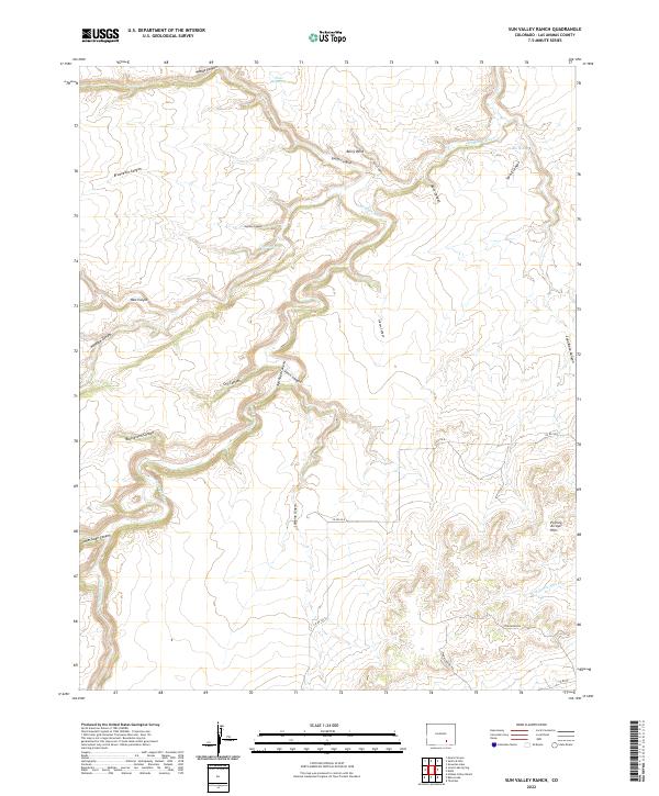
2022 Map of Sun Valley Ranch
USGS Topo · Published 2022About this map
The Apishapa River carves a winding path through this corner of Las Animas County, creating a complex network of drainage systems such as Woods Canyon and South Canyon. This landscape is defined by its dramatic topographic relief, where the Poitrey Arroyo Hills stand in contrast to the deep incisions of Almagre Canyon and Buckletton Canyon. Water management in this arid environment is evident through features like East Reservoir and isolated water sources including Iron Spring and Box Spring. Sparse infrastructure consists primarily of rural routes like Longhorn Rd and Pinon Canyon Rd, which navigate the tablelands between the arroyos. The map illustrates a landscape primarily shaped by natural erosion and limited ranching access, with the Wild Horse Arroyo marking the southern reaches of this transition between canyon floor and elevated plains.
Find a feature on this map
34 named features on this map. Tap any name to fly to it.
Don’t see what you’re looking for? This feature index may not catch every label — zoom into the map to look around manually.
Map Details
Editions of this 2022 Sun Valley Ranch Map
This is the sole edition of this map. No revisions or reprints were ever made.
Other maps of this area

1891 · Apishapa
USGS Topo · 1:125,000

1893 · Apishapa
USGS Topo · 1:125,000

1897 · Apishapa
USGS Topo · 1:125,000

1954 · Trinidad
USGS Topo · 1:250,000

1955 · Trinidad
USGS Topo · 1:250,000

1958 · Trinidad
USGS Topo · 1:250,000

1959 · Trinidad
USGS Topo · 1:250,000
1970 · Snowden Lake
USGS Topo · 1:24,000
1970 · Delhi
USGS Topo · 1:24,000
1970 · Thatcher
USGS Topo · 1:24,000