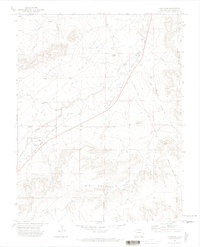
1970 Map of Thatcher
USGS Topo · Published 1974About this map
Thatcher and the small siding of Houghton anchor this high plains landscape during the transition into the 1970s. The region is defined by the critical infrastructure of the Atchison Topeka and Santa Fe RR, which parallels the winding course of Timpas Creek. The presence of an Old Railroad Grade and Pipeline Road highlights the evolution of transit and utility corridors across the arid terrain.
Find a feature on this map
20 named features on this map. Tap any name to fly to it.
Don’t see what you’re looking for? This feature index may not catch every label — zoom into the map to look around manually.
Map Details
Editions of this 1970 Thatcher Map
2 editions found
Other maps of this area

1891 · Timpas
USGS Topo · 1:125,000

1891 · Apishapa
USGS Topo · 1:125,000

1891 · Mesa De Maya
USGS Topo · 1:125,000

1892 · Elmoro
USGS Topo · 1:125,000

1893 · Apishapa
USGS Topo · 1:125,000

1893 · Elmoro
USGS Topo · 1:125,000

1893 · Mesa de Maya
USGS Topo · 1:125,000

1894 · Timpas
USGS Topo · 1:125,000

1897 · Elmoro
USGS Topo · 1:125,000

1897 · Apishapa
USGS Topo · 1:125,000