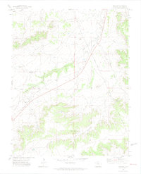
1970 Map of Thatcher
USGS Topo · Published 1974About this map
Thatcher and the smaller station at Houghton serve as the primary human touchpoints in this high plains landscape of southern Colorado. The area is defined by its transit history, where the modern Atchison Topeka and Santa Fe RR parallels the legendary corridor of the Santa Fe Trail. Evidence of shifting infrastructure is visible in the Old Railroad Grade and various water-management features like the Water Tanks and Double Tank Windmill, essential for supporting steam-era rail and cattle ranching in a semi-arid climate.
Find a feature on this map
20 named features on this map. Tap any name to fly to it.
Don’t see what you’re looking for? This feature index may not catch every label — zoom into the map to look around manually.
Map Details
Editions of this 1970 Thatcher Map
2 editions found
Other maps of this area

1891 · Timpas
USGS Topo · 1:125,000

1891 · Apishapa
USGS Topo · 1:125,000

1891 · Mesa De Maya
USGS Topo · 1:125,000

1892 · Elmoro
USGS Topo · 1:125,000

1893 · Apishapa
USGS Topo · 1:125,000

1893 · Elmoro
USGS Topo · 1:125,000

1893 · Mesa de Maya
USGS Topo · 1:125,000

1894 · Timpas
USGS Topo · 1:125,000

1897 · Elmoro
USGS Topo · 1:125,000

1897 · Apishapa
USGS Topo · 1:125,000