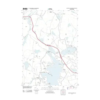
2012 Map of Sunapee Lake North
USGS Topo · Published 2012About this map
Lake Sunapee dominates this landscape, its western and northern shores dotted with distinct landing points and settlements including Lakeside, Georges Mills, and Sunapee. The shoreline is marked by notable navigation aids like the Herrick Cove Lighthouse and the Loon Lighthouse near Loon Island, reflecting a long history of waterborne activity. Inland, the terrain rises toward several named heights such as Mica Mine Hill and Prospect Hill, while the Sugar River drains the lake to the west.
Find a feature on this map
175 named features on this map. Tap any name to fly to it.
Don’t see what you’re looking for? This feature index may not catch every label — zoom into the map to look around manually.
Map Details
Editions of this 2012 Sunapee Lake North Map
This is the sole edition of this map. No revisions or reprints were ever made.
Other maps of this area

1902 · Sunapee
USGS Topo · 1:62,500

1905 · Sunapee
USGS Topo · 1:62,500

1907 · Sunapee
USGS Topo · 1:62,500

1927 · Cardigan
USGS Topo · 1:62,500

1927 · Mascoma
USGS Topo · 1:62,500

1928 · Mount Kearsarge
USGS Topo · 1:62,500

1930 · Cardigan
USGS Topo · 1:62,500

1931 · Mount Kearsarge
USGS Topo · 1:62,500

1932 · Mascoma
USGS Topo · 1:62,500

1949 · Portland
USGS Topo · 1:250,000