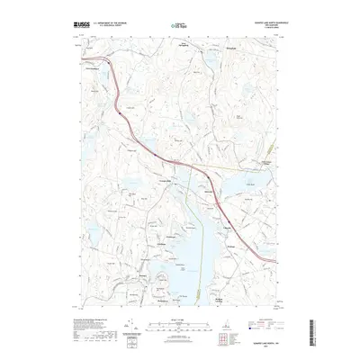
2021 Map of Sunapee Lake North
USGS Topo · Published 2021About this map
Sunapee Lake dominates this landscape in Sullivan and Merrimack Counties, serving as a focal point for several distinct communities and recreational developments. The village of Sunapee and its Sunapee Harbor represent the area's established core, while seasonal and lakeside settlements like Blodgett Landing, Burkehaven, and Granliden line the waterfront. The terrain is characterized by numerous peaks such as Mica Mine Hill and Pitcher Hill, interspersed with smaller water bodies including Kolelemook Lake and the Philbrick Cricenti Bog.
Find a feature on this map
166 named features on this map. Tap any name to fly to it.
Don’t see what you’re looking for? This feature index may not catch every label — zoom into the map to look around manually.
Map Details
Editions of this 2021 Sunapee Lake North Map
This is the sole edition of this map. No revisions or reprints were ever made.
Other maps of this area

1902 · Sunapee
USGS Topo · 1:62,500

1905 · Sunapee
USGS Topo · 1:62,500

1907 · Sunapee
USGS Topo · 1:62,500

1927 · Cardigan
USGS Topo · 1:62,500

1927 · Mascoma
USGS Topo · 1:62,500

1928 · Mount Kearsarge
USGS Topo · 1:62,500

1930 · Cardigan
USGS Topo · 1:62,500

1931 · Mount Kearsarge
USGS Topo · 1:62,500

1932 · Mascoma
USGS Topo · 1:62,500

1949 · Portland
USGS Topo · 1:250,000