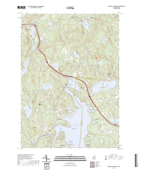
2024 Map of Sunapee Lake North
USGS Topo · Published 2024About this map
Sunapee Lake dominates this northern Sullivan County landscape, serving as the central anchor for a series of historic lakeside settlements and early 21st-century developments. In the village of Sunapee, the Sugar River marks the primary outlet for the lake's waters, while Sunapee Harbor remains a focal point for local navigation. The map documents the intricate network of shoreline communities, from the residential clusters at Georges Mills and Blodgett Landing to the established resort character of Granliden. Moving away from the water, the terrain transitions into significant hills and wetlands, including Mica Mine Hill and the protected Philbrick-Cricenti Bog. Genealogists will find a high density of burial grounds throughout the area, including Eastman Cem East, Eastman Cem West, and the Lower Village Cem. These sites, along with family-named landmarks like Barton Hill and Tucker Hill, provide a detailed record of the long-standing community footprint in this part of New Hampshire.
Find a feature on this map
159 named features on this map. Tap any name to fly to it.
Don’t see what you’re looking for? This feature index may not catch every label — zoom into the map to look around manually.
Map Details
Editions of this 2024 Sunapee Lake North Map
This is the sole edition of this map. No revisions or reprints were ever made.
Other maps of this area

1902 · Sunapee
USGS Topo · 1:62,500

1905 · Sunapee
USGS Topo · 1:62,500

1907 · Sunapee
USGS Topo · 1:62,500

1927 · Cardigan
USGS Topo · 1:62,500

1927 · Mascoma
USGS Topo · 1:62,500

1928 · Mount Kearsarge
USGS Topo · 1:62,500

1930 · Cardigan
USGS Topo · 1:62,500

1931 · Mount Kearsarge
USGS Topo · 1:62,500

1932 · Mascoma
USGS Topo · 1:62,500

1949 · Portland
USGS Topo · 1:250,000