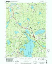
1998 Map of Sunapee Lake North
USGS Topo · Published 2002About this map
Sunapee Lake dominates this late-twentieth-century landscape, its shores dotted with established seasonal communities and traditional settlements. From the bustling Sunapee Harbor to the quieter stretches of Gardner Bay and Herrick Cove, the map documents a region deeply shaped by recreation and summer residence. The presence of Soo Nipi Park, Dewey Beach, and several golf courses underscores this identity, while landmarks like Mica Mine Hill point to the area's geological and extractive past.
Find a feature on this map
88 named features on this map. Tap any name to fly to it.
Don’t see what you’re looking for? This feature index may not catch every label — zoom into the map to look around manually.
Map Details
Editions of this 1998 Sunapee Lake North Map
This is the sole edition of this map. No revisions or reprints were ever made.
Other maps of this area

1902 · Sunapee
USGS Topo · 1:62,500

1905 · Sunapee
USGS Topo · 1:62,500

1907 · Sunapee
USGS Topo · 1:62,500

1927 · Cardigan
USGS Topo · 1:62,500

1927 · Mascoma
USGS Topo · 1:62,500

1928 · Mount Kearsarge
USGS Topo · 1:62,500

1930 · Cardigan
USGS Topo · 1:62,500

1931 · Mount Kearsarge
USGS Topo · 1:62,500

1932 · Mascoma
USGS Topo · 1:62,500

1949 · Portland
USGS Topo · 1:250,000