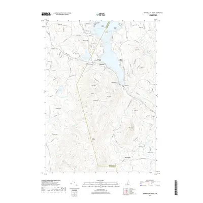
2018 Map of Sunapee Lake South
USGS Topo · Published 2018About this map
Mount Sunapee and its surrounding highlands dominate this landscape where the borders of Sullivan and Merrimack counties meet. The map documents the recreational and natural layout of the region, anchored by the southern reach of Sunapee Lake and its cluster of islands including Great Island and Star Island. Small settlements like Newbury, Edgemont, and Burkehaven are situated along the shoreline and the state's roadway network, reflecting a long history of lakeside community and tourism.
Find a feature on this map
114 named features on this map. Tap any name to fly to it.
Don’t see what you’re looking for? This feature index may not catch every label — zoom into the map to look around manually.
Map Details
Editions of this 2018 Sunapee Lake South Map
This is the sole edition of this map. No revisions or reprints were ever made.
Other maps of this area

1902 · Sunapee
USGS Topo · 1:62,500

1905 · Sunapee
USGS Topo · 1:62,500

1907 · Sunapee
USGS Topo · 1:62,500

1926 · Hillsboro
USGS Topo · 1:62,500

1928 · Mount Kearsarge
USGS Topo · 1:62,500

1929 · Hillsboro
USGS Topo · 1:62,500

1930 · Lovewell Mountain
USGS Topo · 1:62,500

1931 · Mount Kearsarge
USGS Topo · 1:62,500

1942 · Lovewell Mountain
USGS Topo · 1:62,500

1949 · Portland
USGS Topo · 1:250,000