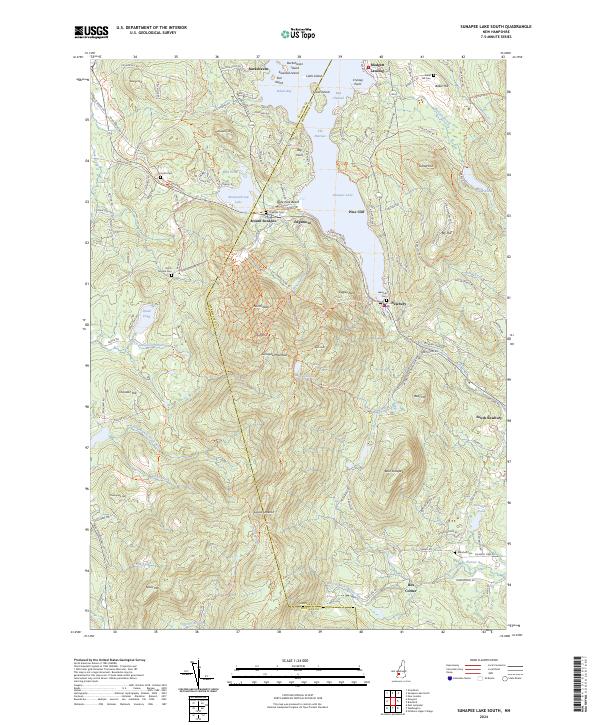
2024 Map of Sunapee Lake South
USGS Topo · Published 2024About this map
Sunapee Lake dominates the northern reaches of this landscape, its waters broken by Great Island and Star Island near the settlement of Burkehaven. The shoreline is dotted with summer colonies and landings including Blodgett Landing and Pine Cliff, while the John Hay National Wildlife Refuge preserves a significant stretch of the eastern coast. To the south, the topography rises sharply toward Sunapee Mountain, where high-elevation features like Lake Solitude and Lucias Lookout overlook the surrounding valleys.
Find a feature on this map
134 named features on this map. Tap any name to fly to it.
Don’t see what you’re looking for? This feature index may not catch every label — zoom into the map to look around manually.
Map Details
Editions of this 2024 Sunapee Lake South Map
This is the sole edition of this map. No revisions or reprints were ever made.
Other maps of this area

1902 · Sunapee
USGS Topo · 1:62,500

1905 · Sunapee
USGS Topo · 1:62,500

1907 · Sunapee
USGS Topo · 1:62,500

1926 · Hillsboro
USGS Topo · 1:62,500

1928 · Mount Kearsarge
USGS Topo · 1:62,500

1929 · Hillsboro
USGS Topo · 1:62,500

1930 · Lovewell Mountain
USGS Topo · 1:62,500

1931 · Mount Kearsarge
USGS Topo · 1:62,500

1942 · Lovewell Mountain
USGS Topo · 1:62,500

1949 · Portland
USGS Topo · 1:250,000