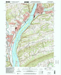
1999 Map of Sunbury
USGS Topo · Published 2001About this map
The Susquehanna River dominates this landscape, serving as the dividing line between Snyder and Northumberland Counties. Along its banks, the industrial and educational character of the region is evident, from the sprawling campus of Susquehanna University in Selinsgrove to the Powerplant and Industrial Waste Pond at Shamokin Dam. A network of islands, including Byers Island and Cherry Island, creates a complex river channel historically navigated near Fishers Ferry.
Find a feature on this map
76 named features on this map. Tap any name to fly to it.
Don’t see what you’re looking for? This feature index may not catch every label — zoom into the map to look around manually.
Map Details
Editions of this 1999 Sunbury Map
This is the sole edition of this map. No revisions or reprints were ever made.
Other maps of this area

1892 · Lykens
USGS Topo · 1:62,500

1892 · Shamokin
USGS Topo · 1:62,500

1893 · Sunbury
USGS Topo · 1:62,500

1893 · Lykens
USGS Topo · 1:62,500

1893 · Shamokin
USGS Topo · 1:62,500

1893 · Millersburg
USGS Topo · 1:62,500

1943 · Millersburg
USGS Topo · 1:62,500

1943 · Lykens
USGS Topo · 1:62,500

1943 · Shamokin
USGS Topo · 1:62,500

1943 · Sunbury
USGS Topo · 1:62,500