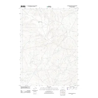
2012 Map of Sundquist Ranch
USGS Topo · Published 2012About this map
Sundquist Ranch sits at the center of this rangeland survey in Converse County, surrounded by the wide-open landscape of Sundquist Flats. The terrain is defined by a sparse but vital network of watercourses that sustain the high plains, including the winding path of Fetterman Cr in the south and Lightning Cr to the north. A web of local roads connects these remote ranching outposts, reflecting the enduring patterns of land use in this part of Wyoming. The hydrology is further detailed by the S Fork Box Cr, which drains the northwestern portion of the quadrangle. This map provides a look at the modern rural infrastructure and natural drainage systems that support large-scale cattle operations in the region.
Find a feature on this map
5 named features on this map. Tap any name to fly to it.
Don’t see what you’re looking for? This feature index may not catch every label — zoom into the map to look around manually.
Map Details
Editions of this 2012 Sundquist Ranch Map
This is the sole edition of this map. No revisions or reprints were ever made.
Other maps of this area

1949 · Sundquist Ranch
USGS Topo · 1:24,000

1949 · Orpha
USGS Topo · 1:24,000

1949 · Gilbert Lake
USGS Topo · 1:24,000

1949 · Douglas
USGS Topo · 1:24,000

1949 · Clausen Ranch
USGS Topo · 1:24,000

1949 · Antelope Creek
USGS Topo · 1:24,000

1950 · Clausen Ranch
USGS Topo · 1:24,000

1950 · Gilbert Lake
USGS Topo · 1:24,000

1950 · Douglas
USGS Topo · 1:24,000

1950 · Orpha
USGS Topo · 1:24,000