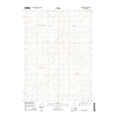
2015 Map of Sundquist Ranch
USGS Topo · Published 2015About this map
Sundquist Ranch sits in the high ranching country of Converse County, highlighting the sparse, expansive nature of this part of Wyoming. The terrain is characterized by the wide Sundquist Flats, a landscape defined by its drainages rather than dense settlement. The drainage network is clearly articulated through the paths of Fetterman Cr, S Fork Box Cr, and Lightning Cr, which carve through the land and dictate the location of local homesteads and access roads. The map illustrates the fundamental relationship between water sources and livestock operations in a region where geography is governed by the Public Land Survey System, as seen in the grid boundaries of t35n r72w and t34n r71w.
Find a feature on this map
9 named features on this map. Tap any name to fly to it.
Don’t see what you’re looking for? This feature index may not catch every label — zoom into the map to look around manually.
Map Details
Editions of this 2015 Sundquist Ranch Map
This is the sole edition of this map. No revisions or reprints were ever made.
Other maps of this area

1949 · Sundquist Ranch
USGS Topo · 1:24,000

1949 · Orpha
USGS Topo · 1:24,000

1949 · Gilbert Lake
USGS Topo · 1:24,000

1949 · Douglas
USGS Topo · 1:24,000

1949 · Clausen Ranch
USGS Topo · 1:24,000

1949 · Antelope Creek
USGS Topo · 1:24,000

1950 · Clausen Ranch
USGS Topo · 1:24,000

1950 · Gilbert Lake
USGS Topo · 1:24,000

1950 · Douglas
USGS Topo · 1:24,000

1950 · Orpha
USGS Topo · 1:24,000