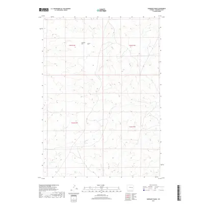
2017 Map of Sundquist Ranch
USGS Topo · Published 2017About this map
Sundquist Ranch sits at the heart of this high plains landscape in Converse County, where the topography is defined by the drainage networks of ephemeral and perennial streams. The land surface transitions across Sundquist Flats, a notable level expanse positioned between the seasonal flows of S Fork Box Cr and Lightning Cr. The mapping of these watercourses, including the winding path of Fetterman Cr in the southern sections, illustrates the essential relationship between water access and ranching operations in this arid region. This 2017 survey captures the enduring rural character of the Wyoming interior, where large-scale land divisions and named ranching landmarks remain the primary features of the human geography.
Find a feature on this map
9 named features on this map. Tap any name to fly to it.
Don’t see what you’re looking for? This feature index may not catch every label — zoom into the map to look around manually.
Map Details
Editions of this 2017 Sundquist Ranch Map
This is the sole edition of this map. No revisions or reprints were ever made.
Other maps of this area

1949 · Sundquist Ranch
USGS Topo · 1:24,000

1949 · Orpha
USGS Topo · 1:24,000

1949 · Gilbert Lake
USGS Topo · 1:24,000

1949 · Douglas
USGS Topo · 1:24,000

1949 · Clausen Ranch
USGS Topo · 1:24,000

1949 · Antelope Creek
USGS Topo · 1:24,000

1950 · Clausen Ranch
USGS Topo · 1:24,000

1950 · Gilbert Lake
USGS Topo · 1:24,000

1950 · Douglas
USGS Topo · 1:24,000

1950 · Orpha
USGS Topo · 1:24,000