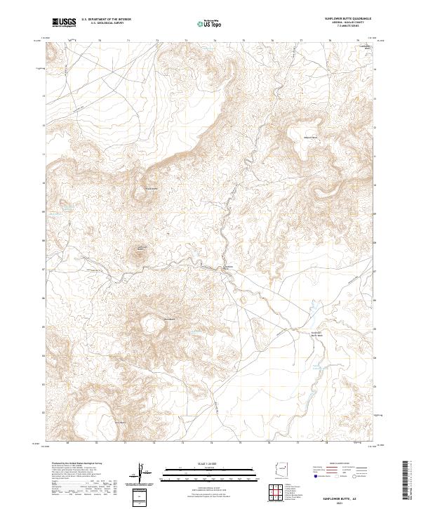
2021 Map of Sunflower Butte
USGS Topo · Published 2021About this map
Sunflower Butte and the dramatic topographic formations of the Navajo nation define this high-desert landscape in northeastern Arizona. This 2021 survey details a region shaped by natural drainage and distinctive geological rises, where the local economy and lifestyle are tied to water sources like Dalkai Spring, Sheep Spring, and Cottonwood Spring. The terrain is characterized by a series of prominent elevations, including the broad Malpais Mesa and the sharp profiles of Sheep Butte, Ram Butte, and Long Butte. Navigating the area relies on a network of tribal routes, such as Indian Rte 9864 and Sunflower Butte Rd, which cross various ephemeral waterways. These include Gleshbito Wash and the significant Pueblo Colorado Wash, which together illustrate the complex hydrology of this arid plateau.
Find a feature on this map
26 named features on this map. Tap any name to fly to it.
Don’t see what you’re looking for? This feature index may not catch every label — zoom into the map to look around manually.
Map Details
Editions of this 2021 Sunflower Butte Map
This is the sole edition of this map. No revisions or reprints were ever made.
Other maps of this area

1883 · Tusayan
USGS Topo · 1:250,000

1886 · Tusayan
USGS Topo · 1:250,000

1947 · Flagstaff
USGS Topo · 1:250,000

1954 · Flagstaff
USGS Topo · 1:250,000

1958 · Flagstaff
USGS Topo · 1:250,000

1960 · Flagstaff
USGS Topo · 1:250,000

1962 · Flagstaff
USGS Topo · 1:250,000
1967 · Dilkon
USGS Topo · 1:24,000
1967 · French Butte
USGS Topo · 1:24,000
1972 · Turkey Track Butte
USGS Topo · 1:24,000