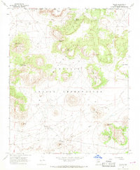
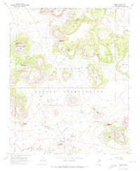
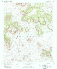
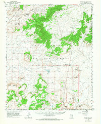
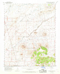
1967 Map of Dilkon
USGS Topo · Published 1968About this map
Dilkon sits at the base of Dilkon Hill in the heart of the Navajo Indian Reservation, serving as a focal point for infrastructure in this high desert landscape during the late 1960s. The settlement is supported by a network of modern developments including a Landing Strip, multiple Pumping Station sites, and a Radio Tower, all linked by a prominent Pipeline that cuts across the southern plains.
Find a feature on this map
27 named features on this map. Tap any name to fly to it.
Don’t see what you’re looking for? This feature index may not catch every label — zoom into the map to look around manually.
Map Details
Editions of this 1967 Dilkon Map
3 editions found
Other maps of this area

1883 · Tusayan
USGS Topo · 1:250,000

1886 · Tusayan
USGS Topo · 1:250,000

1947 · Flagstaff
USGS Topo · 1:250,000

1954 · Flagstaff
USGS Topo · 1:250,000

1958 · Flagstaff
USGS Topo · 1:250,000

1960 · Flagstaff
USGS Topo · 1:250,000

1962 · Flagstaff
USGS Topo · 1:250,000
1966 · White Cone
USGS Topo · 1:62,500
1966 · Egloffstein Butte
USGS Topo · 1:62,500
1967 · French Butte
USGS Topo · 1:24,000
Featured Places
- Fort Defiance Agency
- Dilkon, Fort Defiance Agency
- Cedar Springs, Fort Defiance Agency
- Navajo County, AZ
- United States