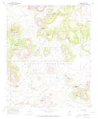
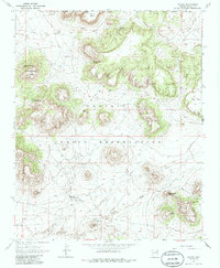
1967 Map of Dilkon
USGS Topo · Published 1974About this map
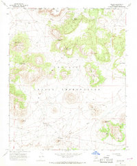
Dilkon sits at the base of Dilkon Hill in this high-desert landscape, serving as a focal point for infrastructure within the Hopi Indian Reservation. The terrain is defined by dramatic mesas and isolated buttes that rise above the drainage networks of Tees Toh Wash and Coyote Wash. The map documents essential water sources for the region, including Tees Toh Spring, Mountainside Spring, and Lone Cottonwood Spring, as well as several Pumping Stations and a Pipeline. Human presence in the mid-1960s is further marked by a Landing Strip and a Radio Tower, reflecting the logistical needs of this tribal land. The geological complexity of the area is evident in landmarks like Turquoise Butte and the prominent Eagle Nest Point, which overlook the expansive Hauke Mesa.
Find a feature on this map
27 named features on this map. Tap any name to fly to it.
Don’t see what you’re looking for? This feature index may not catch every label — zoom into the map to look around manually.
Map Details
Editions of this 1967 Dilkon Map
3 editions found
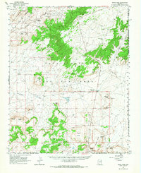
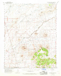
Other maps of this area

1883 · Tusayan
USGS Topo · 1:250,000

1886 · Tusayan
USGS Topo · 1:250,000

1947 · Flagstaff
USGS Topo · 1:250,000

1954 · Flagstaff
USGS Topo · 1:250,000

1958 · Flagstaff
USGS Topo · 1:250,000

1960 · Flagstaff
USGS Topo · 1:250,000

1962 · Flagstaff
USGS Topo · 1:250,000
1966 · White Cone
USGS Topo · 1:62,500
1966 · Egloffstein Butte
USGS Topo · 1:62,500
1967 · Dilkon
USGS Topo · 1:24,000
Featured Places
- Fort Defiance Agency
- Dilkon, Fort Defiance Agency
- Cedar Springs, Fort Defiance Agency
- Navajo County, AZ
- United States