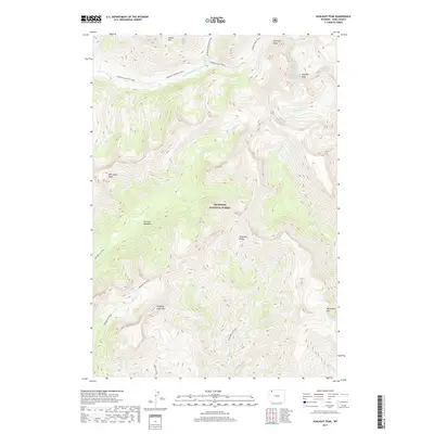
2017 Map of Sunlight Peak
USGS Topo · Published 2017About this map
The high alpine peaks of the Absaroka Range dominate this 2017 survey of the Shoshone National Forest in Wyoming. This landscape is defined by extreme elevation changes, rising from the N Fork Shoshone River valley to iconic summits like Sunlight Peak, Whirlwind Peak, and Sleeping Giant Mtn. The map documents a complex network of backcountry routes essential for navigating this wilderness, including the Pahaska/Sunlight Trail and the Silvertip Basin Trail. Smaller drainages such as Grinnell Cr and Gunbarrel Cr carve through the terrain, leading toward high-altitude clearings like Grinnell Meadows. This detailed topographic record serves as a primary reference for the drainage patterns and peaks within the nation's first national forest.
Find a feature on this map
32 named features on this map. Tap any name to fly to it.
Don’t see what you’re looking for? This feature index may not catch every label — zoom into the map to look around manually.
Map Details
Editions of this 2017 Sunlight Peak Map
This is the sole edition of this map. No revisions or reprints were ever made.
Other maps of this area

1893 · Ishawooa
USGS Topo · 1:125,000

1895 · Ishawooa
USGS Topo · 1:125,000

1896 · Crandall Creek
USGS Topo · 1:125,000

1899 · Crandall
USGS Topo · 1:125,000

1899 · Ishawooa
USGS Topo · 1:125,000

1955 · Cody
USGS Topo · 1:250,000

1956 · Sunlight Peak
USGS Topo · 1:62,500

1956 · Dead Indian Peak
USGS Topo · 1:62,500

1958 · Cody
USGS Topo · 1:250,000

1962 · Cody
USGS Topo · 1:250,000