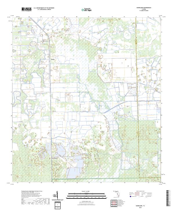
2024 Map of Sunniland
USGS Topo · Published 2024About this map
Sunniland and Harker sit at the center of this 2024 survey of the Big Cypress swamp environment, documenting a landscape where water and land are perpetually intertwined. The southern reaches of the quadrangle are protected within the Florida Panther National Wildlife Refuge, highlighting the region's importance as a critical habitat. The terrain is defined by elongated hydrological features like the Rice Straw Strand, Mud Lake Strand, and Bear Island Strand, which illustrate the slow, south-flowing drainage patterns characteristic of the Everglades ecosystem.
Find a feature on this map
29 named features on this map. Tap any name to fly to it.
Don’t see what you’re looking for? This feature index may not catch every label — zoom into the map to look around manually.
Map Details
Editions of this 2024 Sunniland Map
This is the sole edition of this map. No revisions or reprints were ever made.
Other maps of this area

1956 · West Palm Beach
USGS Topo · 1:250,000

1957 · West Palm Beach
USGS Topo · 1:250,000

1958 · West Palm Beach
USGS Topo · 1:250,000

1958 · Catherine Island
USGS Topo · 1:24,000

1958 · Immokalee
USGS Topo · 1:24,000

1958 · Sunniland
USGS Topo · 1:24,000

1958 · Immokalee NE
USGS Topo · 1:24,000

1958 · Immokalee SW
USGS Topo · 1:24,000

1959 · Miles City
USGS Topo · 1:24,000
1962 · Catherine Island
USGS Topo · 1:24,000