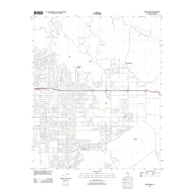
2012 Map of Sunnymead
USGS Topo · Published 2012About this map
Moreno Valley is shown here during a period of significant suburban expansion, where grid-patterned residential developments are set against the prominent natural elevations of the Kalmia Hills and Mount Russell. The map captures the distinct areas of Sunnymead and Moreno, noting their post offices and local landmarks like the Riverside Community College Moreno Valley Campus. The intersection of modern infrastructure and legacy terrain is evident as neighborhoods like Serrano Heights reach toward the high ground of Moonlight Rim and Olive Hill.
Find a feature on this map
237 named features on this map. Tap any name to fly to it.
Don’t see what you’re looking for? This feature index may not catch every label — zoom into the map to look around manually.
Map Details
Editions of this 2012 Sunnymead Map
This is the sole edition of this map. No revisions or reprints were ever made.
Other maps of this area

1896 · San Bernardino
USGS Topo · 1:62,500

1898 · San Bernardino
USGS Topo · 1:62,500

1899 · Redlands
USGS Topo · 1:62,500

1901 · Southern California Sheet No. 1
USGS Topo · 1:250,000

1901 · San Bernardino
USGS Topo · 1:62,500

1901 · Redlands
USGS Topo · 1:62,500

1901 · Elsinore
USGS Topo · 1:125,000

1901 · Riverside
USGS Topo · 1:62,500

1904 · Southern California Sheet No. 1
USGS Topo · 1:250,000
1938 · Colton
USGS Topo · 1:31,680