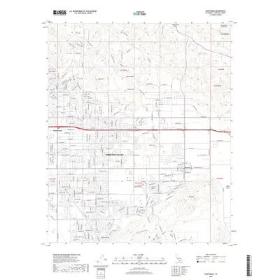
2018 Map of Sunnymead
USGS Topo · Published 2018About this map
Moreno Valley serves as the focal point of this 2018 survey, illustrating the dense suburban expansion between the San Jacinto Mountains and the Kalmia Hills. The landscape reveals a complex network of residential streets and arterial roads like Sunnymead Ranch Pkwy and Perris Blvd, which tie the older settlement area of Sunnymead into the modern city. The geography is defined by the sharp contrast between the developed valley floor and the dramatic, rising elevations of The Badlands to the east and Mt Russell to the south.
Find a feature on this map
219 named features on this map. Tap any name to fly to it.
Don’t see what you’re looking for? This feature index may not catch every label — zoom into the map to look around manually.
Map Details
Editions of this 2018 Sunnymead Map
This is the sole edition of this map. No revisions or reprints were ever made.
Other maps of this area

1896 · San Bernardino
USGS Topo · 1:62,500

1898 · San Bernardino
USGS Topo · 1:62,500

1899 · Redlands
USGS Topo · 1:62,500

1901 · Southern California Sheet No. 1
USGS Topo · 1:250,000

1901 · San Bernardino
USGS Topo · 1:62,500

1901 · Redlands
USGS Topo · 1:62,500

1901 · Elsinore
USGS Topo · 1:125,000

1901 · Riverside
USGS Topo · 1:62,500

1904 · Southern California Sheet No. 1
USGS Topo · 1:250,000
1938 · Colton
USGS Topo · 1:31,680