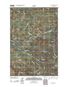
2011 Map of Sunset Spring
USGS Topo · Published 2011About this map
Camp McGregor and the small crossroads at Coyote Corner sit within this heavily forested portion of Clatsop County, where the landscape is defined by the headwaters of the Salmonberry and Rock Creek systems. The mapping reveals a complex network of industrial forest roads, such as the Ginger Creek Mainline and Quartz Creek Mainline, which underscore the region's historical and ongoing reliance on the timber industry. Travelers along the primary highway corridor through these hills pass by the Sunset Safety Rest Area and the eponymous Sunset Spring. The terrain is punctuated by distinctive high points like Green Mountain and the curiously named Dog Thief Point, while numerous drainages including Bear Creek and North Fork Wolf Creek carve through the deep drainages of the Northern Oregon Coast Range.
Find a feature on this map
35 named features on this map. Tap any name to fly to it.
Don’t see what you’re looking for? This feature index may not catch every label — zoom into the map to look around manually.
Map Details
Editions of this 2011 Sunset Spring Map
This is the sole edition of this map. No revisions or reprints were ever made.
Other maps of this area

1937 · Enright
USGS Topo · 1:62,500

1939 · Saddle Mountain
USGS Topo · 1:62,500

1941 · Keasey
USGS Topo · 1:62,500

1941 · Timber
USGS Topo · 1:62,500

1941 · Enright
USGS Topo · 1:62,500

1943 · Keasey
USGS Topo · 1:62,500

1943 · Saddle Mtn.
USGS Topo · 1:62,500

1948 · Vancouver
USGS Topo · 1:250,000

1950 · Vancouver
USGS Topo · 1:250,000

1950 · Vancouver
USGS Topo · 1:250,000