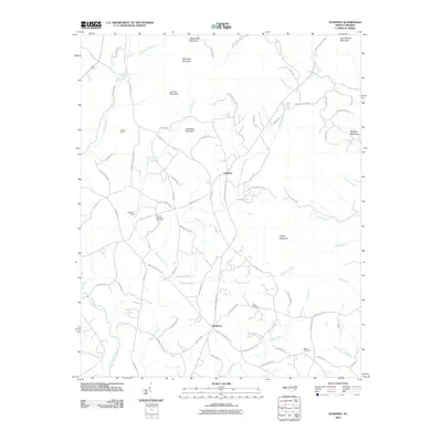
2010 Map of Sunshine
USGS Topo · Published 2010About this map
Sunshine and Washburn anchor this upland landscape in Rutherford County, where a network of family dairy and church roads connects the community. The terrain is defined by a series of prominent peaks, including Lookadoo Mountain, Joshua Mountain, and Cherry Mountain, which rise above the headwaters of the Second Broad River. For those tracing local genealogy or land use, the map documents several rural burial grounds such as Salem Cemetery, Walls Cemetery, and the Mount Lebanon Cemetery near Mount Lebanon Church.
Find a feature on this map
85 named features on this map. Tap any name to fly to it.
Don’t see what you’re looking for? This feature index may not catch every label — zoom into the map to look around manually.
Map Details
Editions of this 2010 Sunshine Map
This is the sole edition of this map. No revisions or reprints were ever made.
Other maps of this area

1905 · Morganton
USGS Topo · 1:125,000

1950 · Shelby
USGS Topo · 1:62,500

1953 · Charlotte
USGS Topo · 1:250,000

1954 · Charlotte
USGS Topo · 1:250,000

1956 · Benn Knob
USGS Topo · 1:24,000

1960 · Charlotte
USGS Topo · 1:250,000

1962 · Charlotte
USGS Topo · 1:250,000
1962 · Glenwood
USGS Topo · 1:24,000
1962 · Dysartsville
USGS Topo · 1:24,000
1965 · Sunshine
USGS Topo · 1:24,000