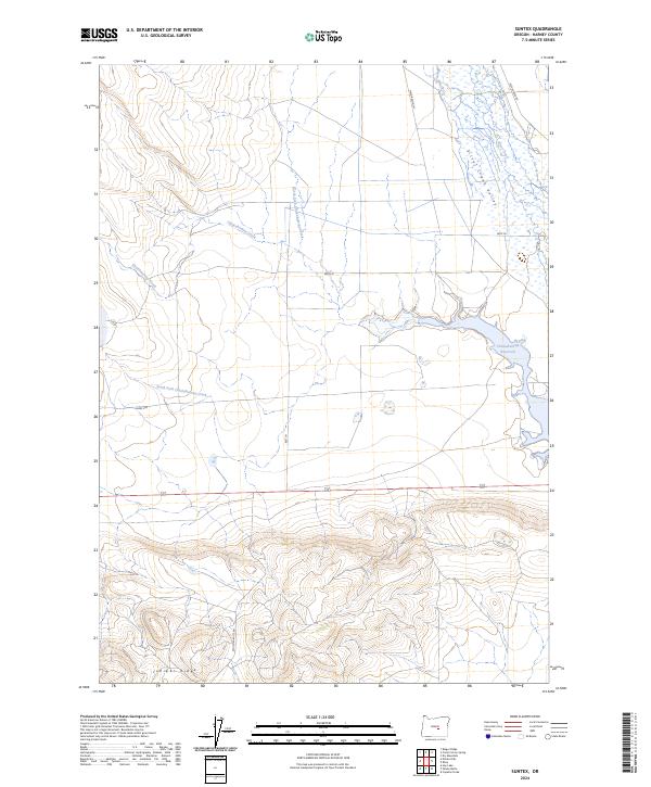
2024 Map of Suntex
USGS Topo · Published 2024About this map
Chickahominy Reservoir anchors this high-desert landscape in Harney County, serving as a primary water source and landmark within the Silver Creek Valley. The terrain is defined by the convergence of the North Fork Chickahominy Creek and South Fork Chickahominy Creek, which drain toward the reservoir across a vast plateau. To the south, the topography rises sharply toward Juniper Ridge, a distinctive upland feature that breaks the relatively level basin. Local infrastructure is sparse, characterized by ranch access routes and property boundaries like Mayo Ranch Ln and Placidia Butte Rd. The arrangement of drainage patterns and named lanes like Best Ln reflects the enduring reliance on these water systems for land management and cattle ranching in the Oregon interior.
Find a feature on this map
17 named features on this map. Tap any name to fly to it.
Don’t see what you’re looking for? This feature index may not catch every label — zoom into the map to look around manually.
Map Details
Editions of this 2024 Suntex Map
This is the sole edition of this map. No revisions or reprints were ever made.
Other maps of this area

1955 · Burns
USGS Topo · 1:250,000

1958 · Burns
USGS Topo · 1:250,000

1959 · Burns
USGS Topo · 1:250,000

1980 · Capehart Lake
USGS Topo · 1:24,000

1980 · Squaw Butte
USGS Topo · 1:24,000

1980 · Hay Lake
USGS Topo · 1:24,000
1981 · Potato Hills
USGS Topo · 1:24,000
1981 · Bulger Ridge
USGS Topo · 1:24,000

1981 · Camp Currey Spring
USGS Topo · 1:24,000
1981 · Suntex
USGS Topo · 1:24,000