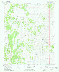
1981 Map of Supai Camp
USGS Topo · Published 1981About this map
Supai Camp sits near the eastern edge of this high-plateau landscape, characterized by an extensive system of water management features necessary for life in the arid Coconino region. Surveyed in the mid-1970s, the map reveals a network of water collection points such as Tank No 15, Tank No 14, and Tank No 3, alongside an Aqueduct that underscores the engineering required to sustain livestock and camps. The terrain is defined by the winding course of Sandstone Wash, which carves through the topography of the Coconino plateau. Small-scale human markers like a Corral and a Nest are noted alongside the primary settlement at Supai Camp, providing specific coordinates for researchers and genealogists interested in the remote ranching and indigenous history of the Grand Canyon’s southern rim area before modern development changed the landscape further.
Find a feature on this map
10 named features on this map. Tap any name to fly to it.
Don’t see what you’re looking for? This feature index may not catch every label — zoom into the map to look around manually.
Map Details
Editions of this 1981 Supai Camp Map
This is the sole edition of this map. No revisions or reprints were ever made.
Other maps of this area

1886 · Chino
USGS Topo · 1:250,000

1886 · Kaibab
USGS Topo · 1:250,000

1891 · Chino
USGS Topo · 1:250,000

1948 · Williams
USGS Topo · 1:250,000

1953 · Grand Canyon
USGS Topo · 1:250,000

1954 · Williams
USGS Topo · 1:250,000

1956 · Williams
USGS Topo · 1:250,000

1957 · Grand Canyon
USGS Topo · 1:250,000

1958 · Grand Canyon
USGS Topo · 1:250,000

1960 · Williams
USGS Topo · 1:250,000