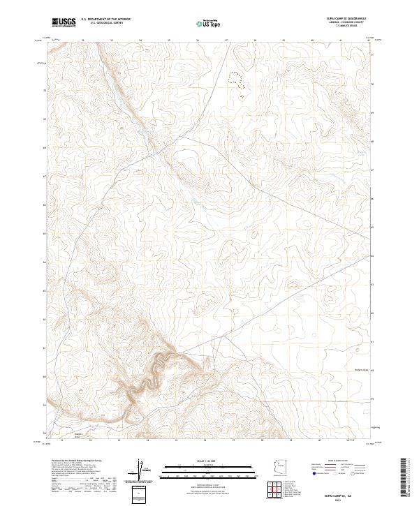
2021 Map of Supai Camp SE
USGS Topo · Published 2021About this map
Sandstone Wash winds through this arid section of Coconino County, defining the drainage patterns of a landscape marked by intermittent water sources and wide draws. The terrain is characterized by its reliance on catchment features such as Lower Sandstone Tank and Midway Tank, which are essential markers in an otherwise open and undeveloped expanse. This 2021 survey reveals a territory primarily organized by the Public Land Survey System, with township and range lines like t28n r5w and t29n r5w providing the only formal structure across the plateau. To the south, the topography transitions into Rodgers Draw, illustrating the subtle yet significant elevation changes that guide seasonal runoff through this high-desert environment.
Find a feature on this map
13 named features on this map. Tap any name to fly to it.
Don’t see what you’re looking for? This feature index may not catch every label — zoom into the map to look around manually.
Map Details
Editions of this 2021 Supai Camp SE Map
This is the sole edition of this map. No revisions or reprints were ever made.
Other maps of this area

1886 · Chino
USGS Topo · 1:250,000

1891 · Chino
USGS Topo · 1:250,000

1948 · Williams
USGS Topo · 1:250,000

1954 · Williams
USGS Topo · 1:250,000

1956 · Williams
USGS Topo · 1:250,000

1960 · Williams
USGS Topo · 1:250,000

1961 · Williams
USGS Topo · 1:250,000
1980 · Rose Well Camp West
USGS Topo · 1:24,000

1980 · Hazen Hole Tank
USGS Topo · 1:24,000
1980 · Black Tank
USGS Topo · 1:24,000