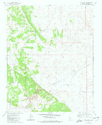
1981 Map of Supai Camp SE
USGS Topo · Published 1981About this map
Sandstone Wash and Rodgers Draw define the drainage patterns across this high-desert landscape in Coconino County. Surveyed in the mid-1970s, the map reveals a remote ranching infrastructure dependent on a network of water collection points. The presence of numerous numbered tanks, such as Water Tank No 2, Water Tank No 8, and the specifically identified Lower Sandstone Tank, suggests a carefully managed system for livestock in an arid environment. An Aqueduct system and several Corrals further underscore the industrial ranching character of the territory. Notable survey markers like the Rosewell Azimuth and various wells, including a Dry Well and Water Tank No 6, provide precise points of reference for those tracing historical land use or topographic change in this section of northern Arizona.
Find a feature on this map
17 named features on this map. Tap any name to fly to it.
Don’t see what you’re looking for? This feature index may not catch every label — zoom into the map to look around manually.
Map Details
Editions of this 1981 Supai Camp SE Map
This is the sole edition of this map. No revisions or reprints were ever made.
Other maps of this area

1886 · Chino
USGS Topo · 1:250,000

1891 · Chino
USGS Topo · 1:250,000

1948 · Williams
USGS Topo · 1:250,000

1954 · Williams
USGS Topo · 1:250,000

1956 · Williams
USGS Topo · 1:250,000

1960 · Williams
USGS Topo · 1:250,000

1961 · Williams
USGS Topo · 1:250,000
1980 · Rose Well Camp West
USGS Topo · 1:24,000

1980 · Hazen Hole Tank
USGS Topo · 1:24,000
1980 · Black Tank
USGS Topo · 1:24,000