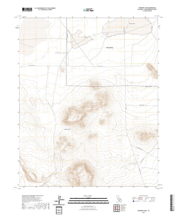
2021 Map of Superior Lake
USGS Topo · Published 2021About this map
Superior Valley dominates the northern reaches of this map, characterized by the dry expanse of Superior Lake and a network of desert thoroughfares. The landscape transitions into the high-relief terrain of the Mojave Desert, where deep contours define unnamed peaks and ridges. The road network suggests a history of remote access and resource extraction, with names like Old Copper City Rd and Copper City Rd hinting at the mining heritage of San Bernardino County.
Find a feature on this map
16 named features on this map. Tap any name to fly to it.
Don’t see what you’re looking for? This feature index may not catch every label — zoom into the map to look around manually.
Map Details
Editions of this 2021 Superior Lake Map
This is the sole edition of this map. No revisions or reprints were ever made.
Other maps of this area

1915 · Searles Lake
USGS Topo · 1:250,000

1933 · Avawatz Mountains
USGS Topo · 1:250,000

1947 · Trona
USGS Topo · 1:250,000

1948 · Trona
USGS Topo · 1:250,000

1948 · Lane Mountain
USGS Topo · 1:62,500

1948 · Goldstone Lake
USGS Topo · 1:62,500

1951 · Goldstone Lake
USGS Topo · 1:62,500

1951 · Lane Mountain
USGS Topo · 1:62,500

1953 · Trona
USGS Topo · 1:250,000

1954 · Pilot Knob
USGS Topo · 1:62,500