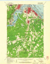
1954 Map of Superior
USGS Topo · Published 1959About this map
Industrial nodes and residential neighborhoods of Duluth and Superior dominate the upper portion of this survey, where the St Louis River opens into St Louis Bay. Planned company housing at Morgan Park and the distinct grid of South Superior are clearly visible, illustrating the mid-century urban layout of the Twin Ports. The map details the dense rail networks of the Northern Pacific and Great Northern railroads that fed the docks at Allouez Bay and Superior Harbor Basin.
Find a feature on this map
108 named features on this map. Tap any name to fly to it.
Don’t see what you’re looking for? This feature index may not catch every label — zoom into the map to look around manually.
Map Details
Editions of this 1954 Superior Map
This is the sole edition of this map. No revisions or reprints were ever made.
Other maps of this area

1895 · Duluth
USGS Topo · 1:62,500

1915 · Superior
USGS Topo · 1:48,000

1917 · Superior
USGS Topo · 1:62,500

1945 · Solon Springs
USGS Topo · 1:48,000

1949 · Solon Springs
USGS Topo · 1:48,000

1949 · Holyoke
USGS Topo · 1:48,000

1949 · Patzau
USGS Topo · 1:48,000

1949 · Poplar
USGS Topo · 1:48,000

1953 · Lakewood
USGS Topo · 1:24,000

1953 · Adolph
USGS Topo · 1:24,000