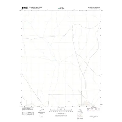
2012 Map of Superior Valley
USGS Topo · Published 2012About this map
Superior Valley and its arid expanse are defined by a network of utilitarian transit routes and military boundaries in this 2012 survey of San Bernardino County. The landscape is dominated by the ephemeral basin of Superior Lake at the southern edge, a terminal point for several local washes. This region has a history of mining and desert transit, evidenced by the presence of Old Copper City Rd and Copper City Rd, which historically connected isolated outposts to larger thoroughfares. The eastern portion of the map is significantly restricted by the boundary of the China Lake Naval Weapons Ctr, reflecting the modern military significance of this desert territory. Local navigation is further delineated by Indian Springs Rd, tracing a path through the flat, high-desert floor between scattered peaks.
Find a feature on this map
6 named features on this map. Tap any name to fly to it.
Don’t see what you’re looking for? This feature index may not catch every label — zoom into the map to look around manually.
Map Details
Editions of this 2012 Superior Valley Map
This is the sole edition of this map. No revisions or reprints were ever made.
Other maps of this area

1915 · Searles Lake
USGS Topo · 1:250,000

1933 · Avawatz Mountains
USGS Topo · 1:250,000

1947 · Trona
USGS Topo · 1:250,000

1948 · Trona
USGS Topo · 1:250,000

1948 · Lane Mountain
USGS Topo · 1:62,500

1948 · Goldstone Lake
USGS Topo · 1:62,500

1951 · Goldstone Lake
USGS Topo · 1:62,500

1951 · Lane Mountain
USGS Topo · 1:62,500

1953 · Trona
USGS Topo · 1:250,000

1954 · Pilot Knob
USGS Topo · 1:62,500