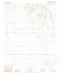
1988 Map of Superior Valley
USGS Topo · Published 1988About this map
Naval Weapons Center operations dominate this high-desert landscape in the late 1980s, where military infrastructure meets the natural basin of Superior Valley. The presence of a Lookout Tower and Heliport alongside a network of 4wd tracks indicates the strategic use of this arid terrain for defense testing and monitoring. To the south, a large depression characterizes the valley floor, terminating at the intermittent waters of Superior Lake. Water sources remain vital markers in this environment, including the isolated Indian Spring to the north and the documented location of Seaburgs Well, which appears here as a dry site. The map reflects the specialized land use within the Naval Reservation Boundary, where technical surveillance and remote operations are established far from civilian settlements.
Find a feature on this map
13 named features on this map. Tap any name to fly to it.
Don’t see what you’re looking for? This feature index may not catch every label — zoom into the map to look around manually.
Map Details
Editions of this 1988 Superior Valley Map
This is the sole edition of this map. No revisions or reprints were ever made.
Other maps of this area

1915 · Searles Lake
USGS Topo · 1:250,000

1933 · Avawatz Mountains
USGS Topo · 1:250,000

1947 · Trona
USGS Topo · 1:250,000

1948 · Trona
USGS Topo · 1:250,000

1948 · Lane Mountain
USGS Topo · 1:62,500

1948 · Goldstone Lake
USGS Topo · 1:62,500

1951 · Goldstone Lake
USGS Topo · 1:62,500

1951 · Lane Mountain
USGS Topo · 1:62,500

1953 · Trona
USGS Topo · 1:250,000

1954 · Pilot Knob
USGS Topo · 1:62,500