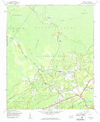
1943 Map of Supply
USGS Topo · Published 1962About this map
Green Swamp dominates the northern reaches of this 1943 survey, revealing a landscape defined by expansive wetlands and isolated rises like Big Island and Little Island. The drainage patterns of the Lockwoods Folly River and its numerous tributaries, including Middle River and Royal Oak Swamp, dictated the early settlement patterns of Brunswick County. Human activity is concentrated along the higher ground of Prospect Ridge, where the community of Prospect is anchored by Prospect Ch. Further east, the village of Supply serves as a local hub near the Royal Oak Bridge. The map also preserves the route of an old Railroad Grade and the Old Williams Br Grade, signaling former timber or industrial operations that once traversed the dense bays and islands like Bear Pen Islands.
Find a feature on this map
31 named features on this map. Tap any name to fly to it.
Don’t see what you’re looking for? This feature index may not catch every label — zoom into the map to look around manually.
Map Details
Editions of this 1943 Supply Map
2 editions found
Other maps of this area

1942 · Juniper Creek
USGS Topo · 1:24,000

1943 · Honey Island
USGS Topo · 1:24,000

1943 · Holden Beach
USGS Topo · 1:24,000

1943 · Exum
USGS Topo · 1:24,000

1943 · Bolivia
USGS Topo · 1:24,000

1943 · Lockwoods Folly
USGS Topo · 1:24,000

1943 · Supply
USGS Topo · 1:24,000

1943 · Lewis Swamp
USGS Topo · 1:24,000

1943 · Shallotte
USGS Topo · 1:24,000

1944 · Supply
USGS Topo · 1:31,680