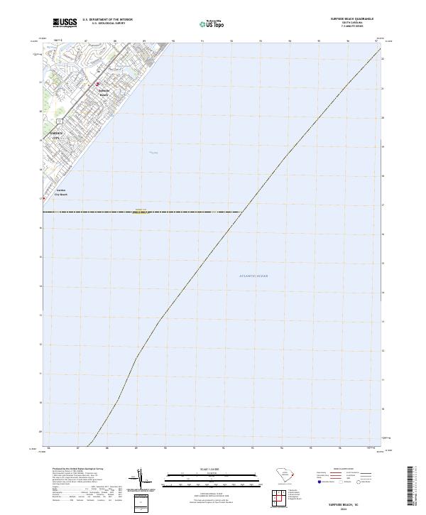
2024 Map of Surfside Beach
USGS Topo · Published 2024About this map
Surfside Beach and Garden City occupy a narrow coastal strip along the South Carolina shoreline, where the dense grid of residential streets and beach access points terminates at the edge of the Atlantic Ocean. The landscape transition from the maritime forest and inland wetlands of Big Swamp to the developed oceanfront is marked by small freshwater bodies like Dogwood Lake and Floral Lake. A significant portion of this coastal survey is dominated by the waters of Long Bay, providing a clear look at the proximity of these seaside communities to the shifting shoreline. The map also delineates the boundary between Horry and Georgetown counties, cutting across the developed beach strand near Garden City Beach.
Find a feature on this map
92 named features on this map. Tap any name to fly to it.
Don’t see what you’re looking for? This feature index may not catch every label — zoom into the map to look around manually.
Map Details
Editions of this 2024 Surfside Beach Map
This is the sole edition of this map. No revisions or reprints were ever made.
Other maps of this area

1937 · Myrtle Beach
USGS Topo · 1:48,000

1940 · Myrtle Beach
USGS Topo · 1:62,500

1942 · Magnolia Beach
USGS Topo · 1:24,000

1943 · Bucksville
USGS Topo · 1:24,000

1943 · Brookgreen
USGS Topo · 1:24,000

1949 · Georgetown
USGS Topo · 1:250,000

1967 · Georgetown
USGS Topo · 1:250,000

1974 · Georgetown
USGS Topo · 1:250,000
1984 · Ocean Forest
USGS Topo · 1:24,000
1984 · Myrtle Beach
USGS Topo · 1:24,000