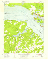
1953 Map of Surry
USGS Topo · Published 1957About this map
Jamestown National Historic Site and the Jamestown Monument (C) anchor the northern bank of the James River in this mid-century portrait of Tidewater Virginia. The landscape reflects centuries of colonial legacy, prominently featuring historic estates such as Four Mile Tree Plantation, Mount Pleasant, and the Smith Fort Plantation near the Warren House. These landings and plantations suggest a river-dependent economy that persisted long after the earliest settlements were established.
Find a feature on this map
69 named features on this map. Tap any name to fly to it.
Don’t see what you’re looking for? This feature index may not catch every label — zoom into the map to look around manually.
Map Details
Editions of this 1953 Surry Map
This is the sole edition of this map. No revisions or reprints were ever made.
Other maps of this area

1906 · Williamsburg
USGS Topo · 1:62,500

1907 · Yorktown
USGS Topo · 1:62,500

1917 · Toano
USGS Topo · 1:62,500

1918 · Toano
USGS Topo · 1:62,500

1919 · Surry
USGS Topo · 1:62,500

1943 · Yorktown
USGS Topo · 1:62,500

1943 · Richmond
USGS Topo · 1:250,000
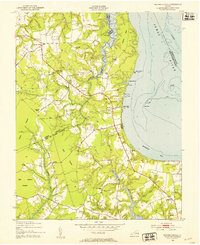
1948 · Bacons Castle
USGS Topo · 1:24,000

1949 · Richmond
USGS Topo · 1:250,000

1950 · Cobham Bay
USGS Topo · 1:24,000