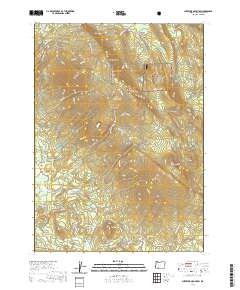
2020 Map of Surveyor Mountain
USGS Topo · Published 2020About this map
Surveyor Mtn and Surveyor Peak anchor the high ground of the Winema National Forest in this upland Klamath County landscape. The area is defined by a dense network of forest roads and spurs, including the Keno Access Rd and specialized logging routes like the Spencer Hook Up E Spur and Kent Spur A. This complex system suggests an active timber economy and management by both the WNF and the BLM. Water resources are critical in this terrain, as evidenced by a concentration of named springs such as Surveyor Meadows Spr, Onion Springs, and Cold Spring. To the south, the terrain descends toward managed water bodies including Lower Sheepy Reservoir and Parker Reservoir, which collect the flow from creeks like Sheepy Cr and Jenny Cr. The inclusion of distinct landmarks like Rock Slide and Cherry Glade provides specific points of interest for navigating this forested high country.
Find a feature on this map
58 named features on this map. Tap any name to fly to it.
Don’t see what you’re looking for? This feature index may not catch every label — zoom into the map to look around manually.
Map Details
Editions of this 2020 Surveyor Mountain Map
This is the sole edition of this map. No revisions or reprints were ever made.
Other maps of this area

1891 · Ashland
USGS Topo · 1:250,000

1893 · Ashland
USGS Topo · 1:250,000

1897 · Ashland
USGS Topo · 1:250,000

1955 · Lake O' Woods
USGS Topo · 1:62,500

1955 · Surveyor Mtn
USGS Topo · 1:62,500

1955 · Hyatt Reservoir
USGS Topo · 1:62,500

1955 · Mt. Mc Loughlin
USGS Topo · 1:62,500

1955 · Medford
USGS Topo · 1:250,000

1957 · Medford
USGS Topo · 1:250,000

1958 · Medford
USGS Topo · 1:250,000