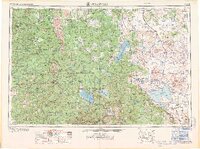
1968 Map of Susanville
USGS Topo · Published 1968About this map
Lassen Peak and the surrounding volcanic landscape of Lassen Volcanic National Park dominate the western portion of this 1968 survey, showing a region defined by dramatic peaks and a network of mountain lakes. The topography transitions from the high elevations of the Shasta National Forest and Lassen National Forest toward the expansive sagebrush basins of the east. This transition is marked by the presence of Honey Lake and the Sierra Army Depot near Herlong.
Find a feature on this map
254 named features on this map. Tap any name to fly to it.
Don’t see what you’re looking for? This feature index may not catch every label — zoom into the map to look around manually.
Map Details
Editions of this 1968 Susanville Map
This is the sole edition of this map. No revisions or reprints were ever made.
Other maps of this area

1886 · Alturas
USGS Topo · 1:250,000

1886 · Honey Lake
USGS Topo · 1:250,000

1886 · Lassen Peak
USGS Topo · 1:250,000

1886 · Modoc Lava Bed
USGS Topo · 1:250,000

1886 · Shasta
USGS Topo · 1:250,000

1886 · Granite Range
USGS Topo · 1:250,000

1888 · Bidwell Bar
USGS Topo · 1:125,000

1889 · Long Valley
USGS Topo · 1:250,000

1890 · Red Bluff
USGS Topo · 1:250,000

1890 · Sierraville
USGS Topo · 1:125,000