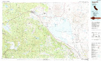
1984 Map of Susanville
USGS Topo · Published 1984About this map
Susanville sits at the foot of the Diamond Mountains, serving as a central hub where the Susan River flows toward the expansive Honey Lake basin. This mid-1980s portrait of Lassen and Plumas counties reveals a landscape defined by significant public and military land holdings, including the sprawling Sierra Army Depot and the Northern Calif Correction Center. The transition from the high desert valley floor to the timbered heights of the Lassen National Forest and Plumas National Forest is clear, with the peaks of Thompson Peak and Diamond Mtn overlooking the settled corridor along Highway 395.
Find a feature on this map
112 named features on this map. Tap any name to fly to it.
Don’t see what you’re looking for? This feature index may not catch every label — zoom into the map to look around manually.
Map Details
Editions of this 1984 Susanville Map
2 editions found
Other maps of this area

1886 · Honey Lake
USGS Topo · 1:250,000

1886 · Lassen Peak
USGS Topo · 1:250,000

1886 · Granite Range
USGS Topo · 1:250,000

1888 · Bidwell Bar
USGS Topo · 1:125,000

1890 · Sierraville
USGS Topo · 1:125,000

1891 · Bidwell Bar
USGS Topo · 1:125,000

1891 · Downieville
USGS Topo · 1:125,000

1891 · Honey Lake
USGS Topo · 1:250,000

1891 · Reno
USGS Topo · 1:125,000

1892 · Sierraville
USGS Topo · 1:125,000