
2011 Map of Sussex
USGS Topo · Published 2011About this map
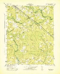
Sussex and West Hope anchor this 2011 survey of the Virginia coastal plain, where the landscape is defined by the winding Nottoway River and a dense network of swamp systems. The map details a rural geography heavily influenced by water management and milling history, notably at Howells Mill and the Hargraves Millpond near Hargraves Dam. These features, along with names like Hunting Quarter Swamp and Beaver Pond Swamp, reflect the long-standing agricultural and timber-based economy of the region.
Find a feature on this map
44 named features on this map. Tap any name to fly to it.
Don’t see what you’re looking for? This feature index may not catch every label — zoom into the map to look around manually.
Map Details
Editions of this 2011 Sussex Map
This is the sole edition of this map. No revisions or reprints were ever made.
Other maps of this area

1894 · Petersburg
USGS Topo · 1:62,500

1919 · Jarratt
USGS Topo · 1:62,500

1919 · Disputanta
USGS Topo · 1:62,500

1919 · Homeville
USGS Topo · 1:48,000

1920 · Homeville
USGS Topo · 1:62,500

1943 · Sebrell
USGS Topo · 1:31,680

1943 · Littleton
USGS Topo · 1:31,680

1943 · Richmond
USGS Topo · 1:250,000

1944 · Reams
USGS Topo · 1:31,680
1944 · Nebletts Mill
USGS Topo · 1:31,680