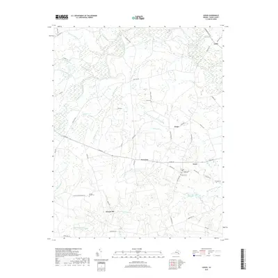
2019 Map of Sussex
USGS Topo · Published 2019About this map
The Sussex County Courthouse serves as the focal point of this rural Virginia landscape, situated near the small crossroads of Sussex. The region is defined by the winding course of the Nottoway River and its expansive wetlands, including Hunting Quarter Swamp and Black Branch Swamp. This environment dictated the early industrial and agricultural footprint of the area, as evidenced by historic sites such as Howells Mill and Hargraves Millpond.
Find a feature on this map
52 named features on this map. Tap any name to fly to it.
Don’t see what you’re looking for? This feature index may not catch every label — zoom into the map to look around manually.
Map Details
Editions of this 2019 Sussex Map
This is the sole edition of this map. No revisions or reprints were ever made.
Other maps of this area

1894 · Petersburg
USGS Topo · 1:62,500

1919 · Jarratt
USGS Topo · 1:62,500

1919 · Disputanta
USGS Topo · 1:62,500

1919 · Homeville
USGS Topo · 1:48,000

1920 · Homeville
USGS Topo · 1:62,500

1943 · Sebrell
USGS Topo · 1:31,680

1943 · Littleton
USGS Topo · 1:31,680

1943 · Richmond
USGS Topo · 1:250,000

1944 · Reams
USGS Topo · 1:31,680
1944 · Nebletts Mill
USGS Topo · 1:31,680