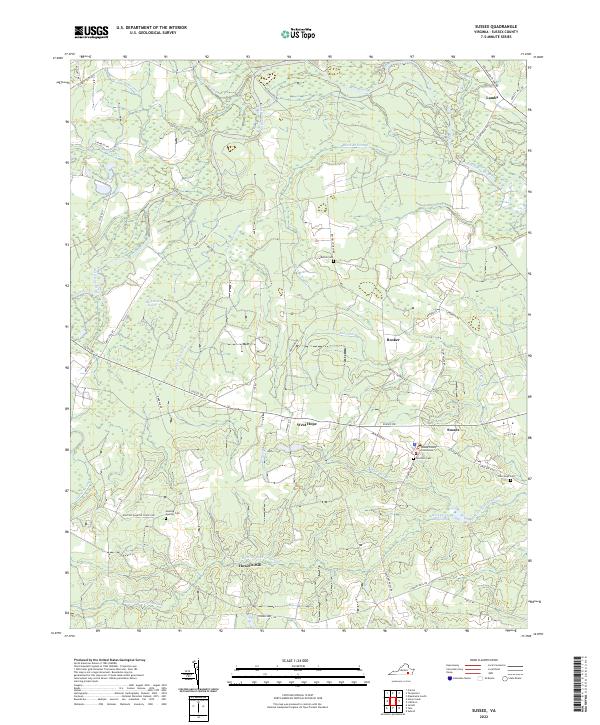
2022 Map of Sussex
USGS Topo · Published 2022About this map
The Sussex County Courthouse serves as the focal point of this rural Virginia landscape, which is defined by an intricate network of wetlands and river systems. The Nottoway River meanders across the upper half of the sheet, surrounded by extensive swamp terrain including Beaver Pond Swamp and Goose Swamp. Small agricultural and residential clusters such as West Hope, Booker, and Lambs are connected by a web of historic routes like Jerusalem Plank Rd and Old Forty Rd. For genealogists and local historians, the map provides precise locations for several community burial sites, including Bethel Cem and Reidville Cem. The southern portion of the quadrangle is dominated by the vast Hunting Quarter Swamp, where the legacy of local industry is reflected in names like Howells Mill and Hargraves Millpond, showing how early settlers utilized the slow-moving water for milling.
Find a feature on this map
49 named features on this map. Tap any name to fly to it.
Don’t see what you’re looking for? This feature index may not catch every label — zoom into the map to look around manually.
Map Details
Editions of this 2022 Sussex Map
This is the sole edition of this map. No revisions or reprints were ever made.
Other maps of this area

1894 · Petersburg
USGS Topo · 1:62,500

1919 · Jarratt
USGS Topo · 1:62,500

1919 · Disputanta
USGS Topo · 1:62,500

1919 · Homeville
USGS Topo · 1:48,000

1920 · Homeville
USGS Topo · 1:62,500

1943 · Sebrell
USGS Topo · 1:31,680

1943 · Littleton
USGS Topo · 1:31,680

1943 · Richmond
USGS Topo · 1:250,000

1944 · Reams
USGS Topo · 1:31,680
1944 · Nebletts Mill
USGS Topo · 1:31,680