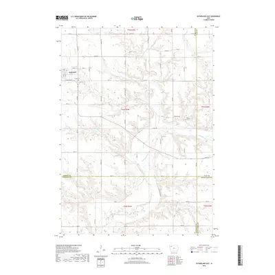
2018 Map of Sutherland East
USGS Topo · Published 2018About this map
Sutherland occupies the northwestern corner of this territory, where the street grid transitions into a vast network of section roads. The landscape is defined by the winding course of the Little Sioux River, which carves through the southern half of the quadrangle. This river valley is fed by several significant tributaries, including Waterman Cr, Dog Creek, and Murray Cr, creating a complex drainage pattern that has historically shaped agricultural land use and settlement in this portion of O'Brien County.
Find a feature on this map
40 named features on this map. Tap any name to fly to it.
Don’t see what you’re looking for? This feature index may not catch every label — zoom into the map to look around manually.
Map Details
Editions of this 2018 Sutherland East Map
This is the sole edition of this map. No revisions or reprints were ever made.
Other maps of this area

1954 · Fairmont
USGS Topo · 1:250,000

1954 · Fort Dodge
USGS Topo · 1:250,000

1957 · Fort Dodge
USGS Topo · 1:250,000

1958 · Fort Dodge
USGS Topo · 1:250,000

1958 · Fairmont
USGS Topo · 1:250,000

1964 · Gaza
USGS Topo · 1:24,000

1970 · Hartley SW
USGS Topo · 1:24,000

1970 · Royal
USGS Topo · 1:24,000

1971 · Peterson SW
USGS Topo · 1:24,000

1971 · Peterson SE
USGS Topo · 1:24,000