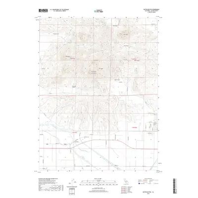
2018 Map of Sutter Buttes
USGS Topo · Published 2018About this map
Sutter Buttes dominates the landscape as a circular complex of eroded volcanic peaks rising sharply from the surrounding agricultural floor of the Sacramento Valley. This survey documents the rugged interior of the range, including prominent summits like West Butte, South Butte, and North Butte, alongside deep incisions such as Brockman Canyon and Braggs Canyon. The map reveals a distinct transition from the steep, uncultivated terrain of the buttes to the reclaimed wetlands and irrigated fields to the south.
Find a feature on this map
53 named features on this map. Tap any name to fly to it.
Don’t see what you’re looking for? This feature index may not catch every label — zoom into the map to look around manually.
Map Details
Editions of this 2018 Sutter Buttes Map
This is the sole edition of this map. No revisions or reprints were ever made.
Other maps of this area

1888 · Marysville
USGS Topo · 1:125,000

1891 · Marysville
USGS Topo · 1:125,000

1894 · Marysville
USGS Topo · 1:125,000

1895 · Marysville
USGS Topo · 1:125,000

1911 · Sutter
USGS Topo · 1:31,680

1911 · Sanborn Slough
USGS Topo · 1:31,680

1911 · Grimes
USGS Topo · 1:31,680

1911 · Gilsizer Slough
USGS Topo · 1:31,680

1912 · Marysville Buttes
USGS Topo · 1:31,680

1912 · Pennington
USGS Topo · 1:31,680