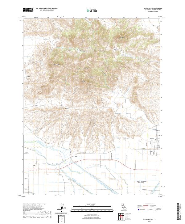
2021 Map of Sutter Buttes
USGS Topo · Published 2021About this map
Sutter Buttes rise dramatically from the floor of the Sacramento Valley, creating a distinct volcanic landscape surrounded by the flat agricultural plains of the Central Valley. This complex of peaks and canyons, including West Butte, South Butte, and Old Craggy, is dissected by numerous drainages like Huff Canyon and Kinch Canyon. The area known as Peace Valley sits at the northern edge of this island mountain range, which is circled by historic routes such as Pass Rd and W Butte Rd.
Find a feature on this map
53 named features on this map. Tap any name to fly to it.
Don’t see what you’re looking for? This feature index may not catch every label — zoom into the map to look around manually.
Map Details
Editions of this 2021 Sutter Buttes Map
This is the sole edition of this map. No revisions or reprints were ever made.
Other maps of this area

1888 · Marysville
USGS Topo · 1:125,000

1891 · Marysville
USGS Topo · 1:125,000

1894 · Marysville
USGS Topo · 1:125,000

1895 · Marysville
USGS Topo · 1:125,000

1911 · Sutter
USGS Topo · 1:31,680

1911 · Sanborn Slough
USGS Topo · 1:31,680

1911 · Grimes
USGS Topo · 1:31,680

1911 · Gilsizer Slough
USGS Topo · 1:31,680

1912 · Marysville Buttes
USGS Topo · 1:31,680

1912 · Pennington
USGS Topo · 1:31,680