
1908 Map of Sutton
USGS Topo · Published 1908About this map
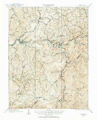
Sutton serves as the central hub of this 1908 survey, situated at a sharp bend in the Elk River where the Baltimore and Ohio Railroad and local wagon roads converge. The landscape is defined by the winding paths of the Holly River, Little Birch River, and Birch River, which dictate the placement of small mountain settlements and transit points. This era of West Virginia history is visible in the dense network of small post offices and sidings, such as Hyer PO, Bakers Run PO, and Custus Siding, which supported the local timber and extraction economies before the mid-century consolidation of rural communities. Transport routes follow the creek beds and ridges, connecting outlying points like Tesla, Centralia, and Erbacon through a complex topography of peaks including High Knob and Fisher Knob. The map also captures the intricate county lines where Braxton, Nicholas, and Webster counties meet in the high country.
Find a feature on this map
94 named features on this map. Tap any name to fly to it.
Don’t see what you’re looking for? This feature index may not catch every label — zoom into the map to look around manually.
Map Details
Editions of this 1908 Sutton Map
2 editions found
Other maps of this area

1889 · Nicholas
USGS Topo · 1:125,000

1891 · Nicholas
USGS Topo · 1:125,000

1891 · Huntersville
USGS Topo · 1:125,000

1893 · Buckhannon
USGS Topo · 1:125,000

1893 · Sutton
USGS Topo · 1:125,000

1894 · Huntersville
USGS Topo · 1:125,000

1896 · Buckhannon
USGS Topo · 1:125,000

1897 · Buckhannon
USGS Topo · 1:125,000

1901 · Nicholas
USGS Topo · 1:125,000

1906 · Glenville
USGS Topo · 1:62,500